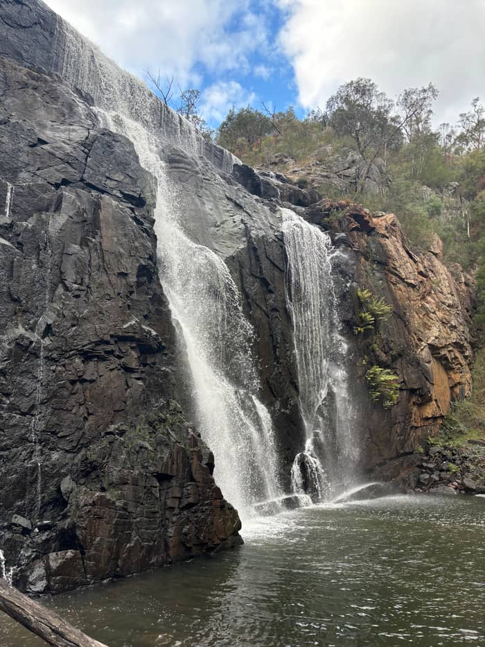
The tour of this site
Small-group eco tour
Grand Canyon walk, no summit
- Length13 hours
- GroupUp to 24
- PinnacleNot on itinerary
- Pricefrom $116
Guides
Language
Currency
See open slotsfrom $116 · cancelling is freeLook up your stop
Short answer
The Pinnacle walk in Grampians National Park takes 1.5 to 2 hours return from the Sundial car park, a 4.2 km route that Parks Victoria calls the easiest.
Route essentials
Look at 44 stops
Pick a route and tap a pin or a stop: you get its note and a Google Maps link.
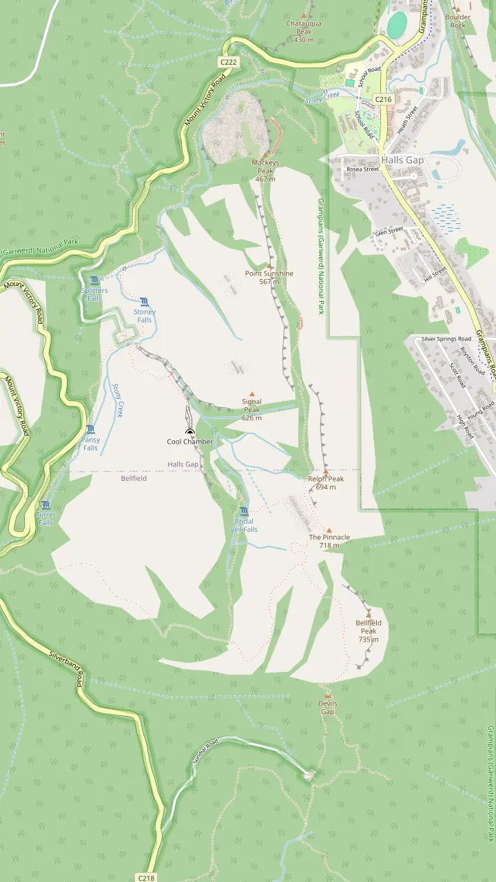
The easiest route to the Pinnacle leaves the Sundial carpark and climbs through Devils Gap.
Google MapsThe climb from the Sundial carpark passes the rock formations of Devil's Gap on its way to the lookout.
Google MapsFrom the Pinnacle lookout you can see Halls Gap far below and Lake Bellfield.
Google MapsThe Wonderland route continues through the Silent Street before rising to the Pinnacle.
Google MapsThe Grand Canyon Loop is a short strenuous scramble through a gorge below towering rock walls.
Google MapsA more challenging route leaves the Wonderland carpark and climbs through the Grand Canyon.
Google MapsPast Venus Baths the rocky track continues to Splitters Falls and then connects to the Wonderland Car Park.
Google MapsThe route from Halls Gap follows a well-formed track to Venus Baths.
Google MapsThe Pinnacle can also be walked from the Halls Gap caravan park, at the base of the mountains.
Google Maps
Mount William is the highest point in the Grampians, reached by a steep climb from the Mt William carpark.
Google MapsThe Mount Rosea walk is a strenuous climb with 360-degree views of the Serra and Mount William Ranges.
Google MapsThe Mount Stapylton loop is an adventurous walk through open forest and over rocky outcrops.
Google MapsThe Hollow Mountain climb reaches wind-scoured caverns near the top, with views of Mount Stapylton and the Wimmera Plains.
Google MapsThe Wonderland Loop is a 10 km strenuous walk from Halls Gap.
Google MapsBoroka Lookout is a short 5-minute stroll to two viewing platforms.
Google MapsThe Mackenzie Falls Walk is 2 km return and goes down 260 narrow steps to the base of the falls.
Google Maps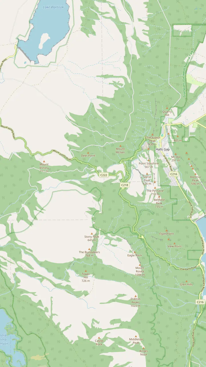
From the summit of Reed Lookout the views take in Victoria Valley, Victoria Range, Serra Range, Lake Wartook and the Mt Difficult Range.
Google MapsFrom the Reed Lookout car park it is a relatively easy 2 km walk on to the Balconies.
Google MapsBoroka Lookout is a short 5-minute stroll to two viewing platforms and suits people with limited mobility.
Google MapsThe Lakeview Loop gives views across the Mount William Range and over Lake Bellfield.
Google MapsSilverband Falls is reached by an easy stroll in the Wonderland Range.
Google MapsBoroka Lookout is 15 km from Halls Gap.
Google Maps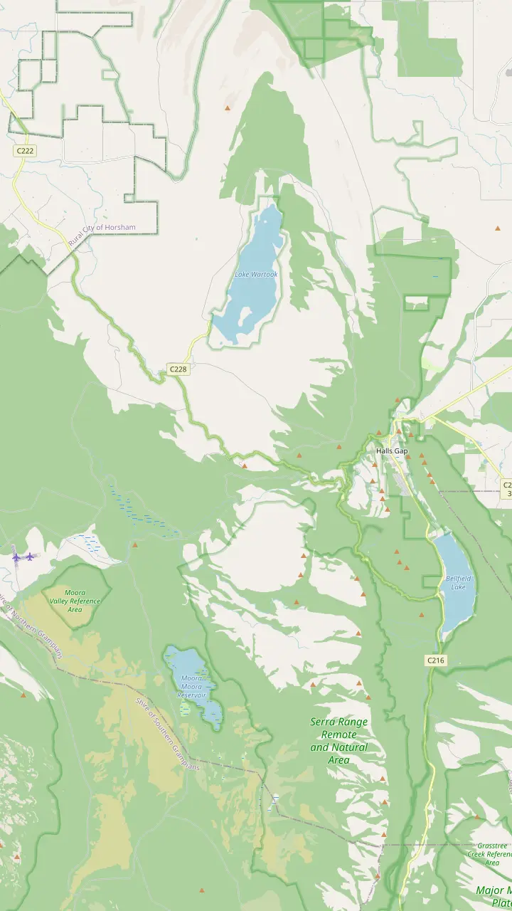
Parks Victoria calls Mackenzie Falls the most iconic and spectacular waterfall in the Grampians.
Google MapsThe Mackenzie Falls Lookout Walk is 1.9 km return and wheelchair friendly.
Google MapsThe Broken Falls Walk is 500 m, wheelchair friendly, with only a slight gradient.
Google MapsThe Zumsteins to Fish Falls walk is a 1.5 to 2 hour return, Grade 3.
Google MapsZumsteins Picnic Area is on the banks of the Mackenzie River at the site of an historic settlement.
Google MapsClematis Falls is an easy 2.4 km return walk and is best seen after rain.
Google MapsSilverband Falls is reached by an easy stroll in the Wonderland Range.
Google MapsSplitters Falls is seasonal and may dry up over summer.
Google Maps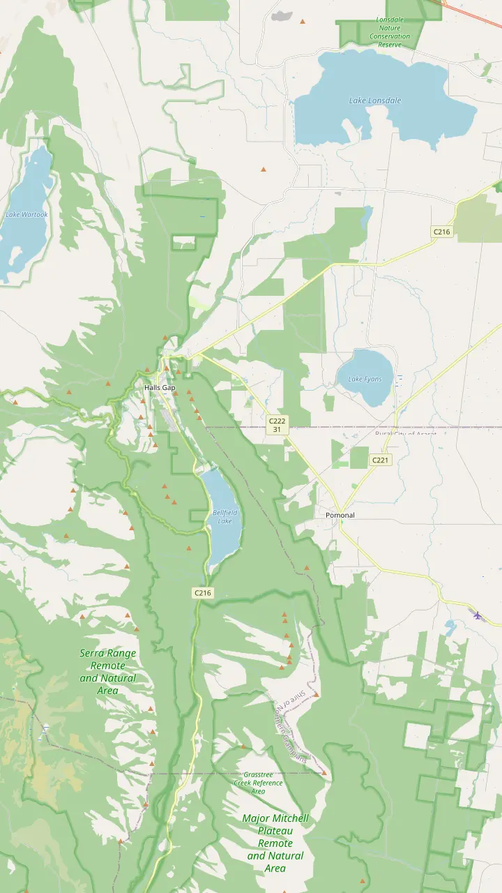
From Halls Gap town you can walk directly to Venus Baths, the Pinnacle, Boronia Peak, Clematis Falls, Chatauqua Peak, Wonderland and Boroka Lookout.
Google MapsThe Brambuk information centre is 2 km south of Halls Gap.
Google MapsHalls Gap Zoo is Victoria's largest regional zoo, with over 120 native and exotic mammals, reptiles and birds.
Google MapsLake Bellfield is 5 km from the main shops in Halls Gap.
Google MapsLake Fyans lies at the foot of the national park, a short drive from Halls Gap.
Google MapsThe Venus Baths loop is a 2.3 km flat track starting in the centre of Halls Gap.
Google MapsWine tours run every Wednesday to Sunday with departures from Halls Gap and Pomonal.
Google Maps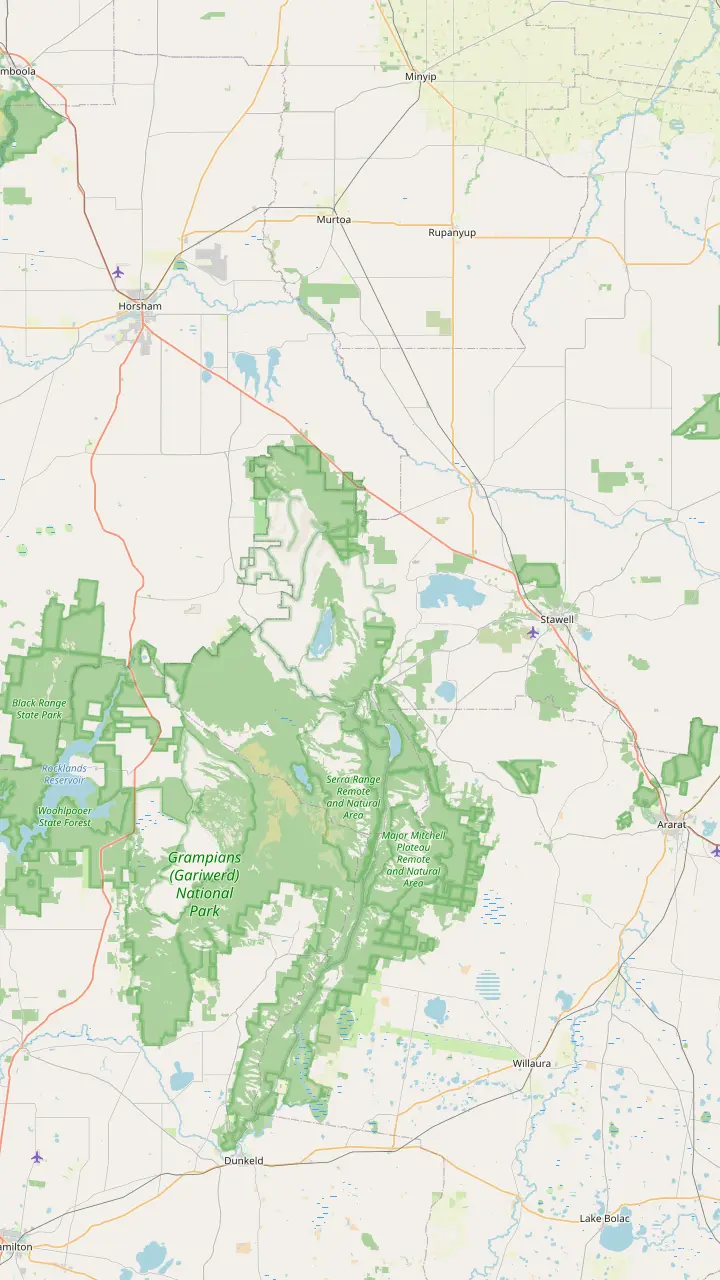
Parks Victoria says to make Brambuk your first stop to learn what Gariwerd-Grampians means to Aboriginal people.
Google MapsBunjil Shelter holds the only known rock art painting of Bunjil, and is a 25-minute drive from Halls Gap.
Google MapsGulgurn Manja has rock art that tells the story of the Jarwadjali people and the landscape they call Gariwerd.
Google MapsThe paintings at Ngamadjidj are unusual because only white clay was used.
Google MapsManja Shelter has some of the best Aboriginal hand stencils in Victoria.
Google MapsBillimina Walk and Rock Art Shelter remain closed because of track damage from the 2024/25 summer bushfires.
Google MapsJadawadjali Falls is a stop on the way up to Billimina Shelter.
Google MapsMap data from © OpenStreetMap contributors
Three ways up to the Pinnacle lookout, from the gentle climb out of the Sundial car park to the Grand Canyon route and the long day on foot from Halls Gap.
Editorial team, grampianstour.top · Updated November 7, 2026 · 6 min reading time
Basics
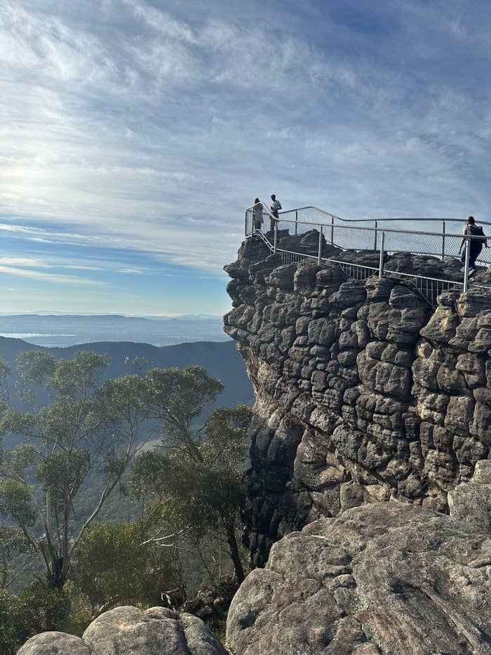
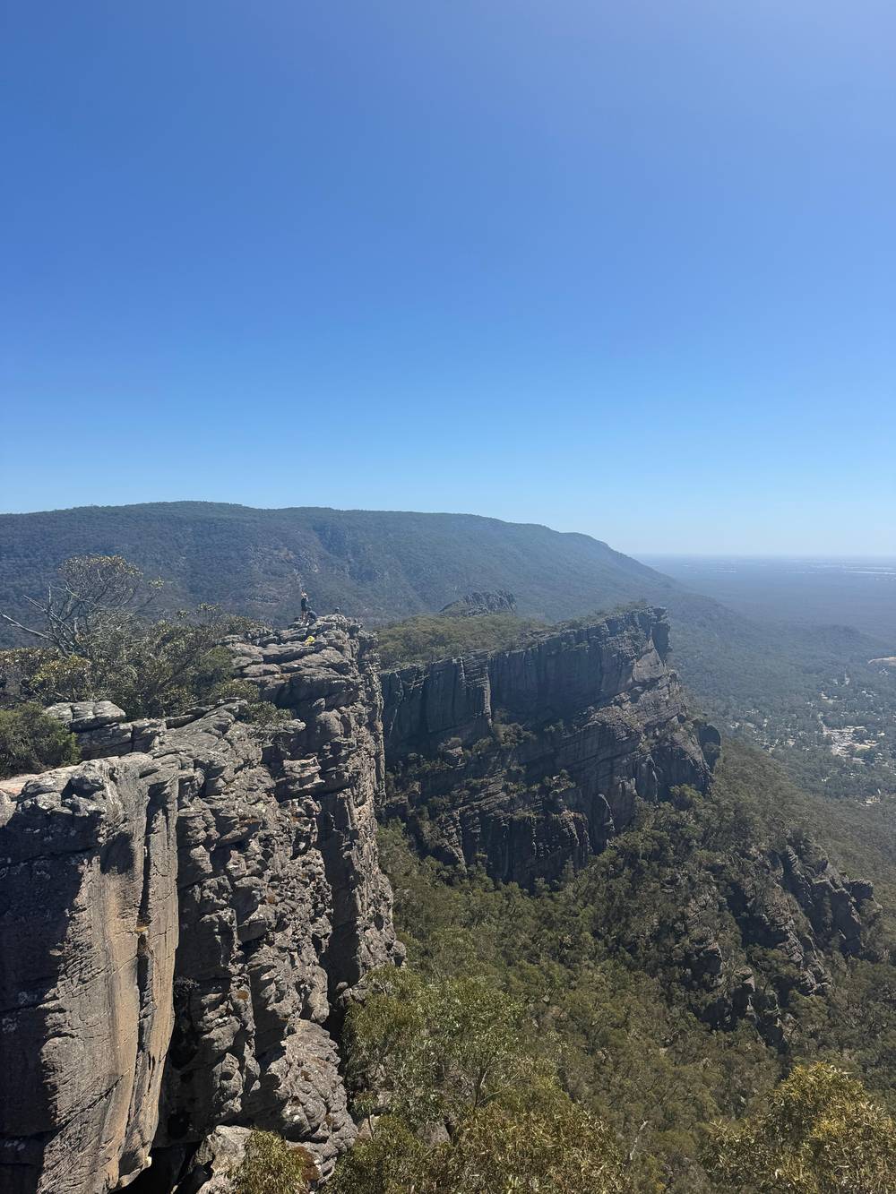
Parks Victoria calls the Pinnacle one of the very best vantage points in the park, with views over a vast expanse of western Victoria.5 The lookout rewards the effort with a picture of the whole valley laid out below the rock.
From the top you can see Halls Gap far below and Lake Bellfield beside it.6 Parks Victoria's own walk description adds the Mount William Range to the view, with the climb passing through rocky woodland on the way up.7 That mix of town, lake and range is what makes the photograph so familiar.
The Pinnacle looks hard from the street, and Parks Victoria admits it appears unnervingly high.8 The same agency also says the steep climb suits fit walkers only.9 Both statements are true at once, and the choice of route settles which one applies to you. This guide sets out each route so you can pick the Pinnacle hike in Grampians National Park that fits your group.
Route by route
| Route | Starts at | Distance | Time | What to expect |
|---|---|---|---|---|
| Sundial | Sundial car park | 4.2 km return1 | 1.5 to 2 hours return1 | Water crossings and rock-hopping4 |
| Wonderland | Wonderland car park | 2.1 km17 | 1 hour 30 minutes17 | Grand Canyon and Silent Street18 |
| Halls Gap | Halls Gap caravan park | 9.6 km19 | Around 5 hours return19 | Venus Baths and Splitters Falls20 |
| Wonderland Loop | Halls Gap | 10 km21 | Full loop | Pinnacle Lookout, Grand Canyon, Venus Baths22 |
Distances and times come from Parks Victoria and Visit Grampians, which measure the routes differently, so treat them as a guide.
Parks Victoria calls this the easiest route: it leaves the Sundial carpark and ascends through Devils Gap.10 The walk is 4.2 km and takes 1.5 to 2 hours for the return trip.1 Visit Grampians measures the same climb as 2.1 km up and a little over 2 hours return with a rest at the top.12 Read the figures as a single route described in different ways.
The track is not a stroll on a boardwalk. Expect to cross water in places and hop between rocks, and wear sturdy shoes.4 Even so, Parks Victoria recommends it if young children or unconfident walkers are in the group.13 Visit Grampians grades it medium on a good track, lists 45 minutes to 1 hour on the way up and says no permit or booking is needed.14,15
The scenery changes as you climb. You move through rocky woodland and past the imposing rock formations of Devil's Gap before reaching the lookout.11 Keep an eye out for native wildlife on the way, from kangaroos to wallabies and even the humble echidna.16 Allow time for photographs at the rock walls.
The harder route starts at the Wonderland carpark and climbs up through the Grand Canyon.2 Parks Victoria describes the Grand Canyon Loop as a short strenuous scramble through a gorge below towering rock walls.25 After the gorge the track continues through the Silent Street before rising to the lookout.18
Visit Grampians lists this route at 2.1 km and 1 hour 30 minutes, on steep, rocky ground, at a medium to hard grade.17 It also warns that rock on this route turns slippery when wet.24 Parks Victoria's hazard list for the Pinnacle Walk names steep track, unstable cliffs, slippery rocks and uneven ground.26 Treat a wet day as a reason to wait.
Walkers who like a loop can fold the Pinnacle into the Wonderland Loop, a 10 km strenuous walk from Halls Gap.21 It takes in the Pinnacle Lookout, the rock formations of the Grand Canyon and the calm water of Venus Baths.22 The loop suits walkers who want the canyon scenery as well as the lookout, and it asks for a good level of fitness.
Pick your route
Choose the line that sounds like your day and the matching route sits beside it.
If I have children or want it easy
Sundial car park route
Parks Victoria recommends it if young children or unconfident walkers are in the group.13
If I want the Grand Canyon scramble
Wonderland car park route
It climbs through the Grand Canyon and then the Silent Street to the lookout.2,18
If I want a whole day on foot
Walk from Halls Gap
It takes around 5 hours return and suits fit and experienced walkers.3
If I want the view with less climbing
Lakeview Loop
Parks Victoria calls the Lakeview Loop an easier and no less spectacular view.23
If I only have the small-group day tour
Grand Canyon on the tour
The itinerary lists a 30-minute Grand Canyon walk, not the Pinnacle.
If The rock is wet
Wait for a dry day
The Wonderland route has rocky areas that can be slippery when wet.24
Compare trips
The tour of this site
Grand Canyon walk, no summit
Hiking option
Boroka and MacKenzie Falls
Longer option
Names the Pinnacles lookout
For the really adventurous, Parks Victoria adds a long option that starts at the Halls Gap caravan park, at the base of the mountains.28 Visit Grampians gives the walk as 9.6 km and around 5 hours return.19 Parks Victoria describes it as suitable for fit and experienced walkers.3
The opening stretch follows a well-formed track to Venus Baths.27 Beyond the pools, the rocky track continues to Splitters Falls and then connects to the Wonderland Car Park.20 Splitters Falls is a seasonal fall that can dry up in summer, so the waterfall can be a trickle in a hot year.42 From the car park the route joins the climb described above.
This is the route for walkers without a car or with a whole day to give. Halls Gap lies far below the lookout, and Visit Grampians notes that trails leave town for Boroka Lookout, Wonderland, Chatauqua Peak, Clematis Falls, Boronia Peak, the Pinnacle and Venus Baths.43 Carry food and plenty of water for the long day.
Sundial route
Car park
The route starts at the Sundial carpark within the national park.10
Woodland
The track climbs through rocky woodland above the car park.11
Rock walls
You pass the imposing rock formations of Devil's Gap.11
Streams
Expect some water crossings and rock-hopping on the way up.4
The top
Halls Gap lies far below, with Lake Bellfield beside it.6
Back down
The return trip takes 1.5 to 2 hours in all.1
Dogs are not allowed on the Pinnacle Walk, and neither are bicycles, horses or fires.68,69 Parks Victoria lists steep track, unstable cliffs, slippery rocks and uneven ground as the terrain hazards.26 Keep to the marked track, especially on the rocky sections near the top, and let faster walkers pass.
The visitor guide advises carrying a quality map and plenty of water and food.63 It also suggests sturdy shoes, a hat, sunscreen and a small first aid kit.64 Mobile phone coverage is unavailable in many areas; do not count on a signal for directions or an emergency call.67 Pick up a walking map from Brambuk before you set off.70
Time the walk so that you are back well before dusk.65 Fire danger shapes the day as well: on Catastrophic Fire Danger Rating days the park is closed for public safety.66 Check the conditions on the day you walk: the track, car parks and roads can all change at short notice in bushfire season.
Video
Trails Trails Trails on YouTube · Video data is requested only when you tap play.
It is one of the very best vantage points in the Grampians National Park for terrific scenic views over a vast expanse of western Victoria
Before you climb
The Pinnacle in Grampians National Park lies in a park that is a 3-hour (260 km) drive from Melbourne and a 5-hour (460 km) drive from Adelaide.71 A Pinnacle climb on a day trip competes with the drive for daylight. Sleeping in Halls Gap and starting early keeps the whole range within reach on foot.
The small-group day tour sold on this site is a 13-hour day with a 30-minute Grand Canyon walk that includes rock hopping, steep sections and gravel. The same record does not list the Pinnacle or MacKenzie Falls, and the summit is not part of that itinerary. Parks Victoria groups the Pinnacle, Mt Rosea and Mackenzie Falls as the more challenging half-day walks.72
If the climb is more than you want, Parks Victoria points to an easier option: the Lakeview Loop from Sundial Carpark gives an easier and no less spectacular view.23 It looks across the Mount William Range and over Lake Bellfield.32 The Sundial Peak walk crosses the southern slopes of the Wonderland Range for views over Mount Rosea and Lake Bellfield.73
Every route offers rock formations to see and negotiate, along with green regrowth since the bushfires.74 The regrowth is part of the walk now, and the green against the grey sandstone is a reason to look down as well as out. Walkers who knew the range before the fires will notice how much has come back.
Spring brings the colour. Parks Victoria says wildflowers burst into life along the Pinnacle walks in springtime.75 Visit Grampians adds that the best time to see nearby Splitters Falls is spring, when the wildflowers around the falls are in colour.76 A walker who times the climb for spring may find flowers and flowing water in the same trip, though neither is guaranteed in any given week.
Wildlife shares the track. Parks Victoria says you may glimpse koalas, kangaroos, snakes, skinks and an echidna on the way.77 Keep to the track and watch where your hands and feet land on rocky ledges, since snakes and skinks like warm stone. Do not feed any animal you meet: visitors are asked to keep wildlife wild.78
FAQ
Parks Victoria gives the Sundial car park route as 4.2 km and 1.5 to 2 hours for the return trip.1
The easiest route starts at the Sundial car park; a harder one starts at the Wonderland car park and climbs through the Grand Canyon.79
Visit Grampians lists permits and bookings as none required for both the Sundial and Wonderland routes.15
Parks Victoria states that dogs are not allowed on the Pinnacle Walk.68
The walk from the Halls Gap caravan park is 9.6 km and takes around 5 hours return, so it suits fit and experienced walkers.19
The record for the 13-hour day lists a Grand Canyon walk of 30 minutes but does not list the Pinnacle.
Sources
Further reading
Questions about the Grampians day? A real person answers here.