The tour of this site
Small-group eco tour
Silverband Falls, no Mackenzie
- Length13 hours
- Waterfall stopSilverband Falls
- Stop time30 minutes
- Pricefrom $116
Guides
Language
Currency
See open slotsfrom $116 · cancelling is freeLook up your stop
Short answer
Mackenzie Falls in Grampians National Park is closed for construction works from 9 February 2026, and Parks Victoria expects the works to finish by the end of 2026.
Closure essentials
Look at 44 stops
Pick a route and tap a pin or a stop: you get its note and a Google Maps link.
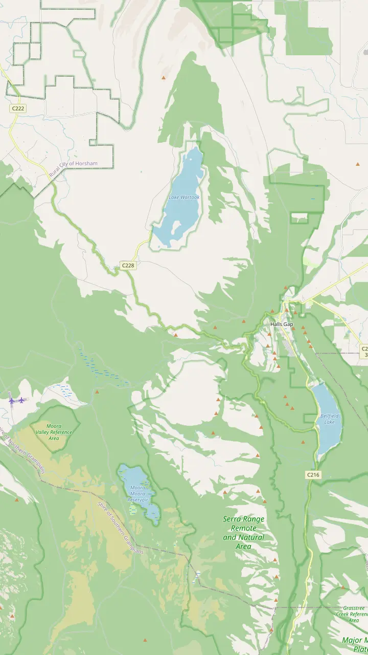
Parks Victoria calls Mackenzie Falls the most iconic and spectacular waterfall in the Grampians.
Google MapsThe Mackenzie Falls Lookout Walk is 1.9 km return and wheelchair friendly.
Google MapsThe Broken Falls Walk is 500 m, wheelchair friendly, with only a slight gradient.
Google MapsThe Zumsteins to Fish Falls walk is a 1.5 to 2 hour return, Grade 3.
Google MapsZumsteins Picnic Area is on the banks of the Mackenzie River at the site of an historic settlement.
Google MapsClematis Falls is an easy 2.4 km return walk and is best seen after rain.
Google MapsSilverband Falls is reached by an easy stroll in the Wonderland Range.
Google MapsSplitters Falls is seasonal and may dry up over summer.
Google Maps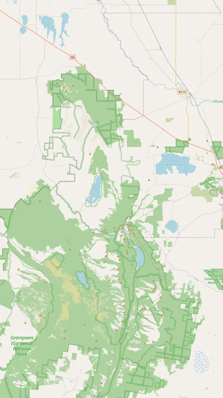
Mount William is the highest point in the Grampians, reached by a steep climb from the Mt William carpark.
Google MapsThe Mount Rosea walk is a strenuous climb with 360-degree views of the Serra and Mount William Ranges.
Google MapsThe Mount Stapylton loop is an adventurous walk through open forest and over rocky outcrops.
Google MapsThe Hollow Mountain climb reaches wind-scoured caverns near the top, with views of Mount Stapylton and the Wimmera Plains.
Google MapsThe Wonderland Loop is a 10 km strenuous walk from Halls Gap.
Google MapsBoroka Lookout is a short 5-minute stroll to two viewing platforms.
Google MapsThe Mackenzie Falls Walk is 2 km return and goes down 260 narrow steps to the base of the falls.
Google Maps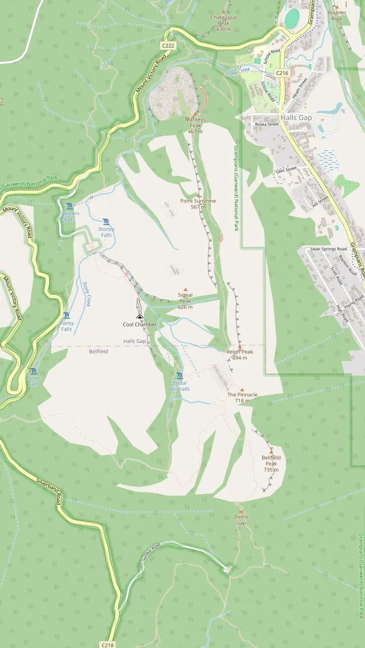
The easiest route to the Pinnacle leaves the Sundial carpark and climbs through Devils Gap.
Google MapsThe climb from the Sundial carpark passes the rock formations of Devil's Gap on its way to the lookout.
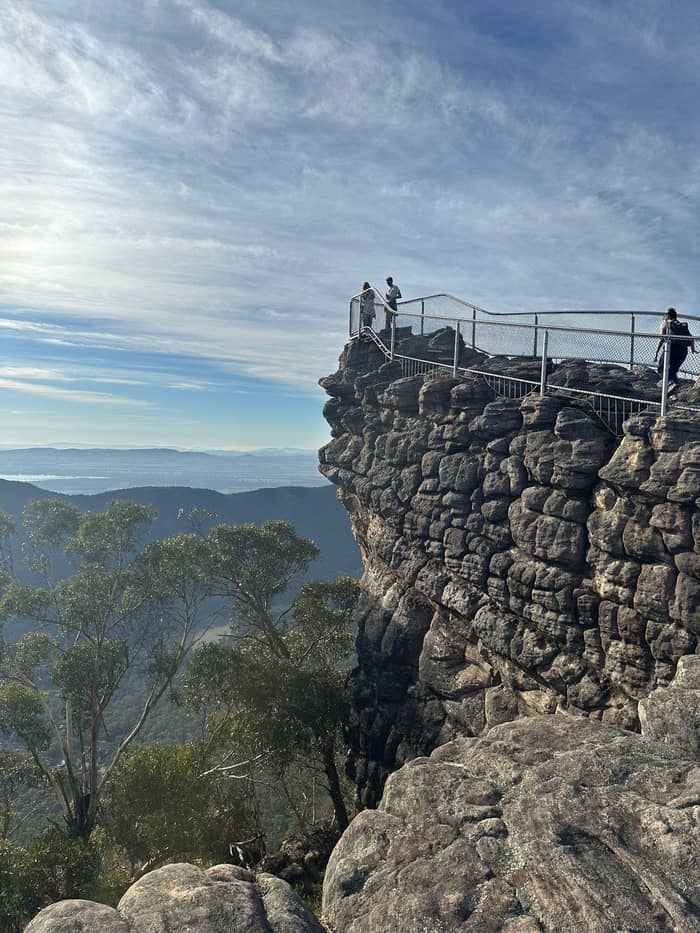
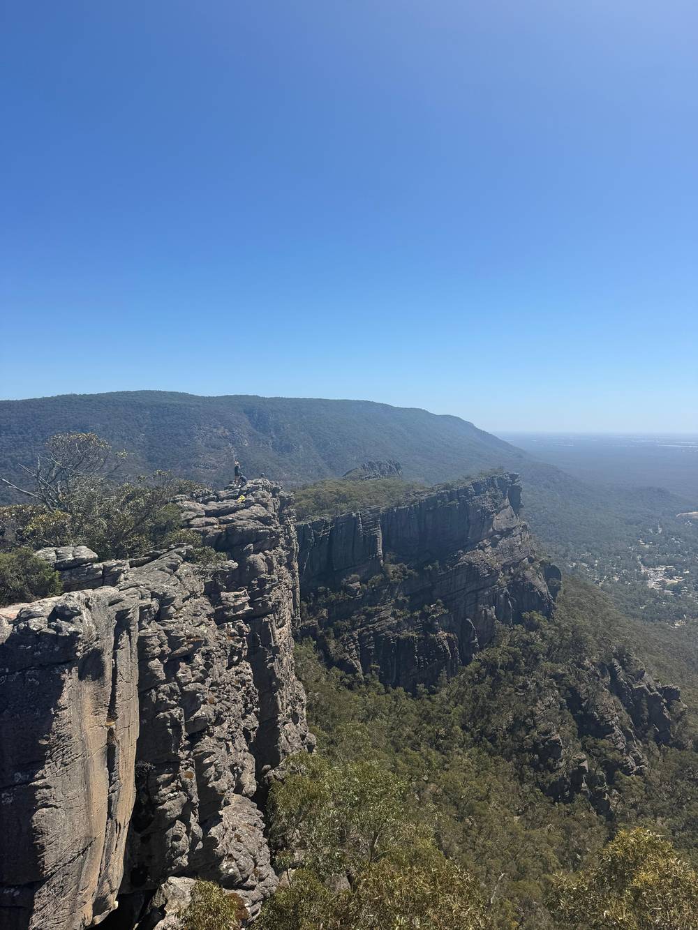
Google MapsFrom the Pinnacle lookout you can see Halls Gap far below and Lake Bellfield.
Google MapsThe Wonderland route continues through the Silent Street before rising to the Pinnacle.
Google MapsThe Grand Canyon Loop is a short strenuous scramble through a gorge below towering rock walls.
Google MapsA more challenging route leaves the Wonderland carpark and climbs through the Grand Canyon.
Google MapsPast Venus Baths the rocky track continues to Splitters Falls and then connects to the Wonderland Car Park.
Google MapsThe route from Halls Gap follows a well-formed track to Venus Baths.
Google MapsThe Pinnacle can also be walked from the Halls Gap caravan park, at the base of the mountains.
Google Maps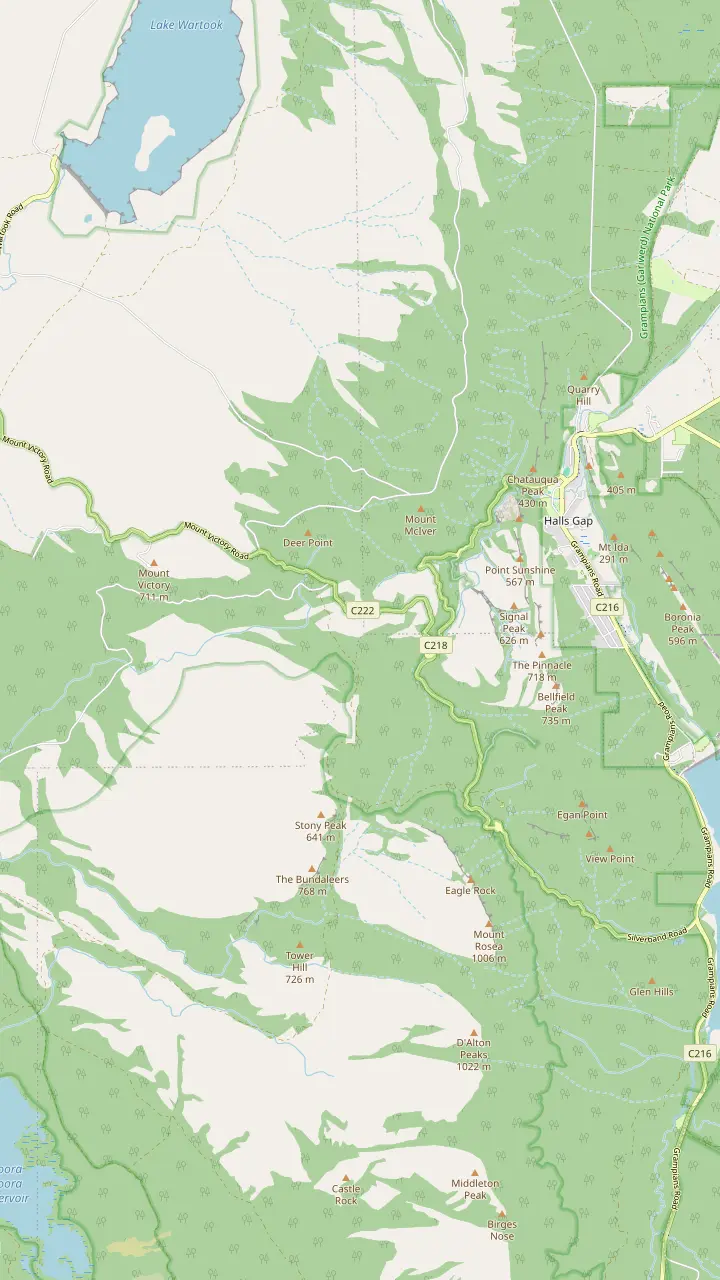
From the summit of Reed Lookout the views take in Victoria Valley, Victoria Range, Serra Range, Lake Wartook and the Mt Difficult Range.
Google MapsFrom the Reed Lookout car park it is a relatively easy 2 km walk on to the Balconies.
Google MapsBoroka Lookout is a short 5-minute stroll to two viewing platforms and suits people with limited mobility.
Google MapsThe Lakeview Loop gives views across the Mount William Range and over Lake Bellfield.
Google MapsSilverband Falls is reached by an easy stroll in the Wonderland Range.
Google MapsBoroka Lookout is 15 km from Halls Gap.
Google Maps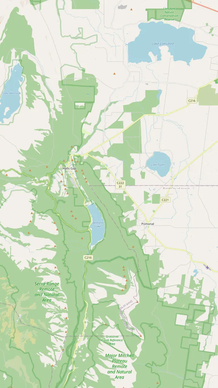
From Halls Gap town you can walk directly to Venus Baths, the Pinnacle, Boronia Peak, Clematis Falls, Chatauqua Peak, Wonderland and Boroka Lookout.
Google MapsThe Brambuk information centre is 2 km south of Halls Gap.
Google MapsHalls Gap Zoo is Victoria's largest regional zoo, with over 120 native and exotic mammals, reptiles and birds.
Google MapsLake Bellfield is 5 km from the main shops in Halls Gap.
Google MapsLake Fyans lies at the foot of the national park, a short drive from Halls Gap.
Google MapsThe Venus Baths loop is a 2.3 km flat track starting in the centre of Halls Gap.
Google MapsWine tours run every Wednesday to Sunday with departures from Halls Gap and Pomonal.
Google Maps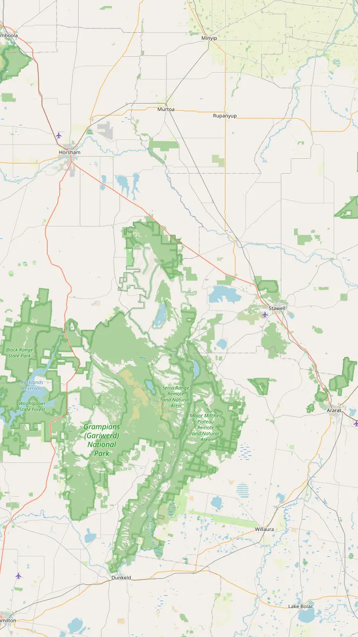
Parks Victoria says to make Brambuk your first stop to learn what Gariwerd-Grampians means to Aboriginal people.
Google MapsBunjil Shelter holds the only known rock art painting of Bunjil, and is a 25-minute drive from Halls Gap.
Google MapsGulgurn Manja has rock art that tells the story of the Jarwadjali people and the landscape they call Gariwerd.
Google MapsThe paintings at Ngamadjidj are unusual because only white clay was used.
Google MapsManja Shelter has some of the best Aboriginal hand stencils in Victoria.
Google MapsBillimina Walk and Rock Art Shelter remain closed because of track damage from the 2024/25 summer bushfires.
Google MapsJadawadjali Falls is a stop on the way up to Billimina Shelter.
Google MapsMap data from © OpenStreetMap contributors
The Mackenzie Falls precinct is closed for building works through 2026. Here is what that closes, what stays open and which other waterfalls are worth the walk.
Editorial team, grampianstour.top · Updated November 7, 2026 · 7 min reading time
Basics
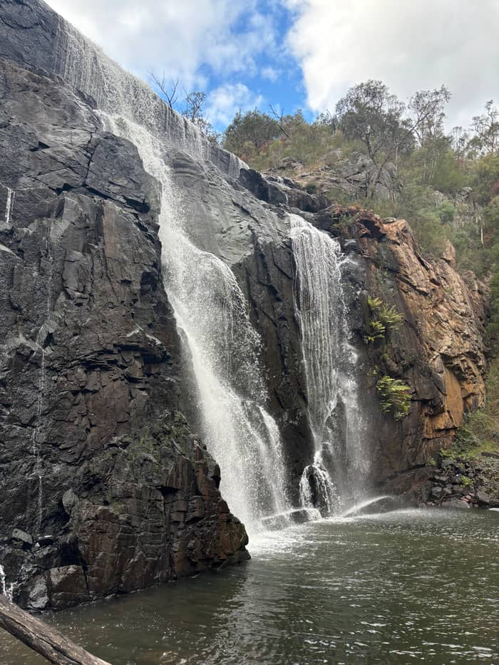
Parks Victoria calls Mackenzie Falls the most iconic and spectacular waterfall in the Grampians.6 It is one of the largest waterfalls in Victoria, and it is the one waterfall in the Grampians that keeps flowing all year.7,8 The falls also carry an Aboriginal name, Migunang wirab, and lie on Jardwadjali and Djab Wurrung Traditional Lands.9
The water drops over a sheer cliff into a deep pool, and the walk to the base lets you feel the spray. The pool is not for swimming. Parks Victoria says swimming is not permitted because of many unseen dangers in the water, and describes strong currents, submerged objects and cold, deep water.4,10 Its project page repeats that swimming is prohibited at the falls.11
Visit early in the day to escape the crowds, as Parks Victoria suggests.12 The walks to the falls start at the carpark and suit a range of abilities, from a short accessible path to a steep descent.13 Parks Victoria's Mackenzie Falls page says the precinct, including the path to Fish Falls, closes on days of Catastrophic Fire Danger, while its main park page says Extreme and Catastrophic, so check the forecast before you drive out.14,15 The waterfalls in Grampians National Park run strongest after rain, and Mackenzie is the exception that keeps flowing.
Walk by walk
| Walk | Return distance | What to expect | Status in 2026 |
|---|---|---|---|
| Falls base walk | 2 km26 | 260 narrow steps26 | Closed with the precinct16 |
| Lookout Walk | 1.9 km25 | Wheelchair friendly25 | Closed with the precinct16 |
| Broken Falls Walk | 500 m24 | Wheelchair friendly24 | Closed with the precinct16 |
| Mackenzie River Walk | 7 km, Fish Falls 4 km27 | Water crossings, rock hopping27 | Zumsteins to Fish Falls stays open3 |
The status column follows Parks Victoria's notices, read on 7 November 2026; conditions can change, so check its conditions page before you travel.28
Parks Victoria announced a closure of the Mackenzie Falls precinct for major construction works from 9 February 2026 to the end of 2026.1 The works include a viewing platform built at the foot of the falls, carpark upgrades and an upgrade of the Bluff Lookout Walk, along with safety improvements to stabilise rock.19
The closure covers the carpark and every track in the Mackenzie Falls precinct: the Broken Falls Walk, the walk down to the base, the Bluff Lookout Walk and sections of the Mackenzie Falls River Walk.16 There is no access for vehicles or visitors during construction.20 The project page, last updated in July 2026, repeats that there is no access to the car park, the day visitor area or the walks from the precinct.21,22
Practical effects follow. From May 2026 until the works are complete, the base of the falls cannot be reached by the river walk from Zumsteins Picnic Area.17 Parking at Zumsteins is limited, especially for large vehicles at weekends and holiday periods.23 Parks Victoria expects the work to finish by the end of 2026, so check its conditions page before you plan a visit near the turn of the year.2
The Mackenzie Falls Walk is 2 km return and goes down 260 narrow steps to the base of the falls, which makes the climb back to the top a difficult one.26 Parks Victoria warns that the steps and rocks can be very slippery.32 Wear shoes with grip and take the steps at your own pace.
The Mackenzie Falls Lookout Walk is 1.9 km return, wheelchair friendly, and winds through stringybark forest to the Bluff Lookout.25 The lookout is the spot that shows several cascades of the river running through the gorge.33 The Broken Falls Walk is a short 500 m (0.5 km) path, also wheelchair friendly, with only a slight gradient.24 Broken Falls Lookout shows the geological formations of the Mackenzie River Gorge.34
Parks Victoria describes the Broken Falls walk as a short, accessible walk with views of the upper falls and no climb of over 200 stairs.35 Together the short walks cover every angle of the cascade: down at the pool, across the valley and along the top. Each takes a fraction of the time of the river walk, and the base walk and the lookout walk can be combined into a morning.
Pick your waterfall
Choose the line that fits your day and the matching waterfall sits beside it.
If I want water in any month
Mackenzie Falls
It is the one waterfall in the Grampians that keeps flowing all year.8
If I want a waterfall during the works
Fish Falls from Zumsteins
The return walk from Zumsteins to Fish Falls stays open during the works.3
If I want an easy walk from town
Clematis Falls
It is an easy 2.4 km return walk, best viewed after rain.5
If I want flowers with my waterfall
Splitters Falls in spring
Spring is when the wildflowers around the falls are in colour.29
If I want a cool dip
Venus Baths
Its rock pools are a place to cool off on a warm summer day.30
If I want a short, easy stroll
Silverband Falls
It is an easy stroll along a fern-laden trail in the Wonderland Range.31
Tours and the falls
The tour of this site
Silverband Falls, no Mackenzie
Comparison tour
Names MacKenzie Falls
Comparison tour
Names MacKenzie Falls
Assessments found a risk of rockfalls, and three areas will be made safer.75 The new platform at the foot of the falls will hold at least 40 people at a time.76 Its design will carry elements of the blackfish, a species important to the cultural landscape of Migunang wirab.77
The Bluff Lookout track will be upgraded to a Grade 1 walk suitable for prams, wheelchairs and limited mobility.18 Once complete, the precinct will have 120 car parking spaces in all, plus 14 for long vehicles.78 The changes aim at safer pedestrian access and better traffic flow.
Until the works end, treat any guidebook description of the old track as out of date. Planning a trip around the reopening needs a flexible date: the page says construction is anticipated to finish by the end of 2026, and Parks Victoria's conditions page is the place to confirm when the doors open.2 If you can only visit during the works, put the Fish Falls walk and the lookouts at the top of your list.
Closure timeline
Works begin
The carpark and tracks close when construction starts on Monday, 9 February, 2026.16
From May
The base of the falls is no longer reachable from Zumsteins.17
Meanwhile
The return walk from Zumsteins to Fish Falls can still be completed.3
End of the year
Parks Victoria anticipates construction will finish by the end of 2026.2
After
The Bluff Lookout track becomes a Grade 1 walk.18
Visitors can still do the out-and-back walk between Zumsteins Picnic Area and Fish Falls.3 Parks Victoria gives it as a 1.5 to 2 hour return walk at Grade 3.51 Walkers need a reasonable fitness level, water and sturdy shoes, since the track is rocky and uneven in places, with some steep sections.74
The wider Mackenzie River Walk is 7 km return, with Fish Falls at 4 km return, and can need water crossings, rock hopping and rock scrambling.27 The track runs through eucalypt forest and alongside the terraced cascades of Fish Falls.79 Beyond them lies the base of Mackenzie Falls, which is the stretch currently closed.
Zumsteins Picnic Area stands on the banks of the Mackenzie River at the site of an historic settlement.52 The walk can end with a picnic or barbecue and a look at the remnants, including old buildings and a now-empty swimming pool.80 Parks Victoria also names the Silverband, Fish and Turret Falls as further cascades in the central Grampians.81
Video
Pavo TREKS on YouTube · Video data is requested only when you tap play.
Mackenzie Falls is the most iconic and spectacular waterfall in the Grampians
Before you go
Parks Victoria counts small seasonal waterfalls among the Grampians' special treats.82 Clematis Falls is an easy 2.4 km return walk to the rear of the Recreation Reserve and is best viewed after rain.5 Parks Victoria agrees that it is best viewed after rain and an easy stroll from Halls Gap, and Visit Grampians notes the walk suits families.83,84
Splitters Falls is a seasonal fall that can dry up in summer, and spring is the time when wildflowers surround it in colour.53,29 The path to it follows Stony Creek from the centre of town to Venus Baths.85 Venus Baths is fed by Stony Creek, and its naturally formed rock pools are a place to cool off on a warm summer day.30
Turret Falls rewards a short walk with a pretty terraced waterfall, best viewed after rain.86 Silverband Falls is an easy stroll in the Wonderland Range.31 That last walk is the one the small-group day tour sold here includes, with a 30-minute walk to the falls on an easy-grade track.
Down south, fairly short walks lead to Kalymna Falls and Burrong Falls, both spectacular after rain.87 Jadawadjali Falls makes a pleasant stop on the climb to Billimina Shelter, a rock overhang with Aboriginal art.68 The Billimina Walk and Rock Art Shelter itself remains closed to visitors after bushfire track damage, according to the Parks Victoria notice read on 7 November 2026.67,28 These walks start well away from Halls Gap, and the unsealed roads are worth checking before you go.
Nigretta Falls is a small waterfall fed by the Wannon River, a short detour from the Glenelg Highway with picnic tables and barbecue facilities.88 Visit Grampians says you can see the falls in full flow after heavy rains, and that entry is free.89,90 It lies off the Halls Gap circuit, so plan it as a separate stop.
Visit Grampians considers Nigretta Falls more spectacular than Wannon Falls because its features are clearer.91 Treat Nigretta as a bonus on a drive along the highway rather than a reason to cross the park. The flow changes with the rain, so a dry spell leaves a small waterfall and a wet week fills it.
FAQ
The Mackenzie Falls Walk is 2 km return and goes down 260 narrow steps to the base.26
It is the one waterfall in the Grampians that keeps flowing all year.8
Clematis Falls is an easy 2.4 km return walk from the Recreation Reserve and is best viewed after rain.5
The itinerary lists a 30-minute walk to Silverband Falls and does not list MacKenzie Falls.
Sources
Further reading
Questions about the Grampians day? A real person answers here.